By Datapleth.io | January 1, 2016
One of the big problem for anybody interested in China and data science is the availability of data sets. There are limited free resources available and they are often incomplete or inaccurate. Getting data and especially cleaning data becomes one of the biggest pain of data science applied to China.
The objective of this series of post is to illustrate the problem and associated process on a specific example: plot a map of the airports of mainland China.
In this forth part, we merge the two data obtained in part 2 and part 3 sets by IATA.FAA code and will clean / fix missing data. We will create the separate data set with the complement which will be fixed in next part.
In order to compare and fix missing or wrong data we are going to use different tools :
stringdistfrom the package of the same name to check the distance between two chains of characters- the Google map API which give back elevation for a set of longitude / latitude
Dependencies
We will need few standard packages as loaded bellow.
library(maptools)
library(reshape2)
library(grid)
library(dplyr)
library(ggplot2)
library(jsonlite)
library(Amelia)
library(OpenStreetMap)
library(stringdist)
library(grid)
library(knitr)
## For satellite image analysis
library(slippymath)
library(glue)
library(raster)
library(png)
library(purrr)
library(curl)
# get API from system environment
api_mapbox <- Sys.getenv("API_MAPBOX")
api_elevation <- Sys.getenv("API_GOOG_ELEVATION")Loading part 3 objects
load(file = "./data/chinese-airports-part-3.Rda")Merging the two datasets by IATA.FAA code and extracting complements
We will use IATA.FAA codes to identify the airports. First let’s create subset of airport with and without IATA codes.
OAwoIATA <- airportChinaOurairports[is.na(airportChinaOurairports$IATA.FAA),]
OAwithIATA <- airportChinaOurairports[!is.na(airportChinaOurairports$IATA.FAA),]
OFwoIATA <- airportChinaOpenflights[is.na(airportChinaOpenflights$IATA.FAA),]
OFwithIATA <- airportChinaOpenflights[!is.na(airportChinaOpenflights$IATA.FAA),]
Let’s merge the two sub data sets with IATA code present. Then we isolate the remaining airport which have no match. Regroup with airport without IATA and check if there are possible match by ICAO codes.
## Merge by IATA, drop non matchin case
IATA <- merge(OAwithIATA, OFwithIATA, by = "IATA.FAA")
nrow(IATA)
## [1] 179## Extract OA airports not matching IATA code from OF
## And regroup with Airports without IATA
OAout <- OAwithIATA[!(OAwithIATA$IATA.FAA %in% IATA$IATA.FAA),]
OAout <- rbind(OAout, OAwoIATA)
## Extract OF airports not matching IATA code from OA
OFout <- OFwithIATA[!(OFwithIATA$IATA.FAA %in% IATA$IATA.FAA),]
OFout <- rbind(OFout, OFwoIATA)
## Check if there could be match by ICAO codes when present
sum(OAout[!is.na(OAout$ICAO),] %in% OFout[!is.na(OFout$ICAO),])## [1] 0We have now three data sets to work on :
IATAwhich contains common airports by IATA code between openflight and ourairport data set. We need to define a strategy to select or merge their parameters if data is different (which elevation choose when different, which name, etc…)OFoutairport from Openflight which have no match by IATA nor ICAO in ourairport data or no IATA/ICAO code.OAoutairport from ourairport which have no match by IATA nor ICAO in openflights data or no IATA/ICAO code
For the two last data set, we merge them and we will have to find a way to collect missing data and add these to IATA data set in the later part of this report.
# add missing categories to OFout
OFout$type.airport <- NA
OFout$scheduled.service <- NA
OFout$airport.wikipedia.link <- NA
OFout$region.name <- NA
airports_2_check <- rbind(OFout, OAout)

missmap(IATA, main = "Missingness map for merged airport list by IATA.FAA Code")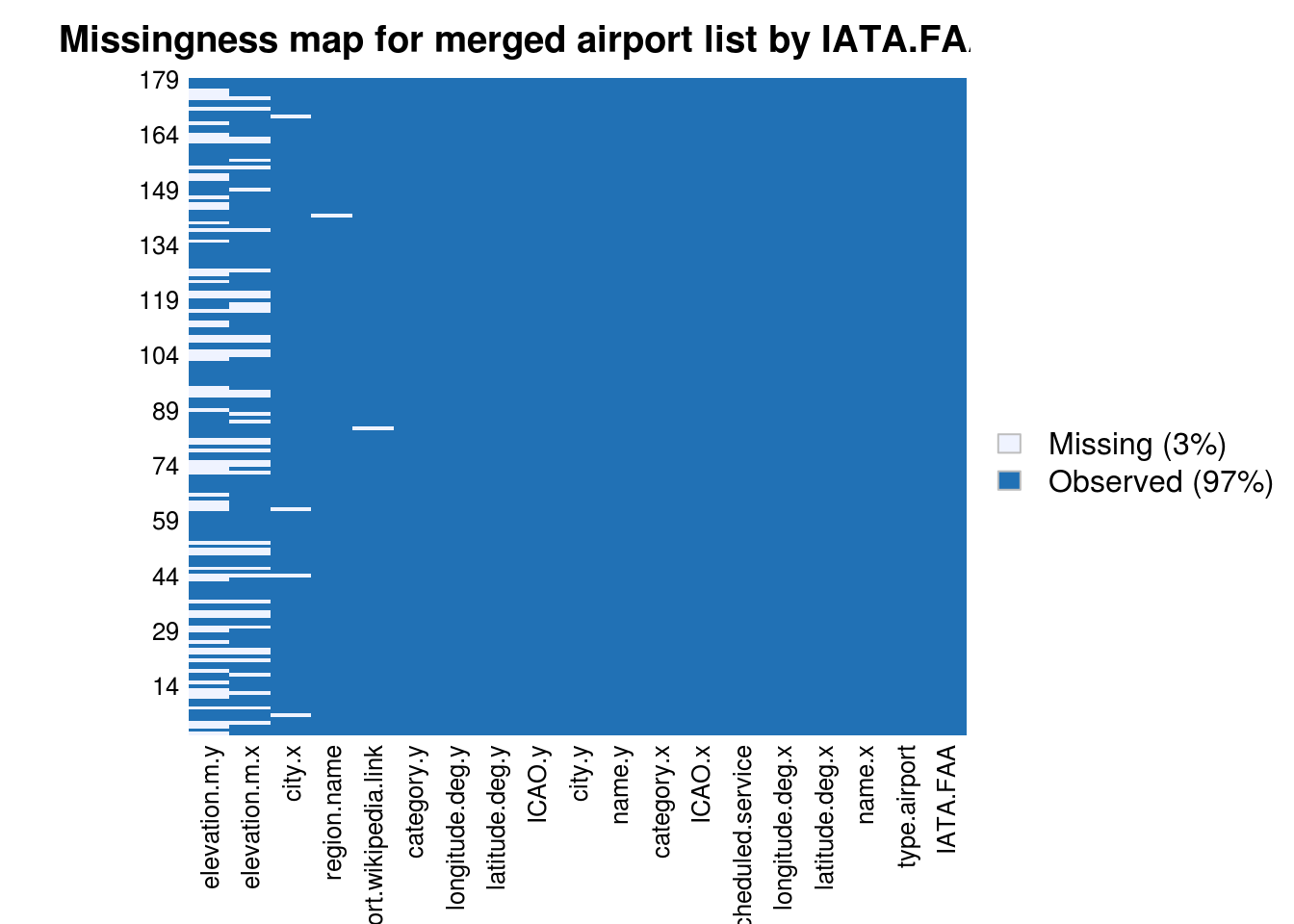
missmap(airports_2_check, main = "Missingness map for remaining airports to be checked (not in both OA / OF sets")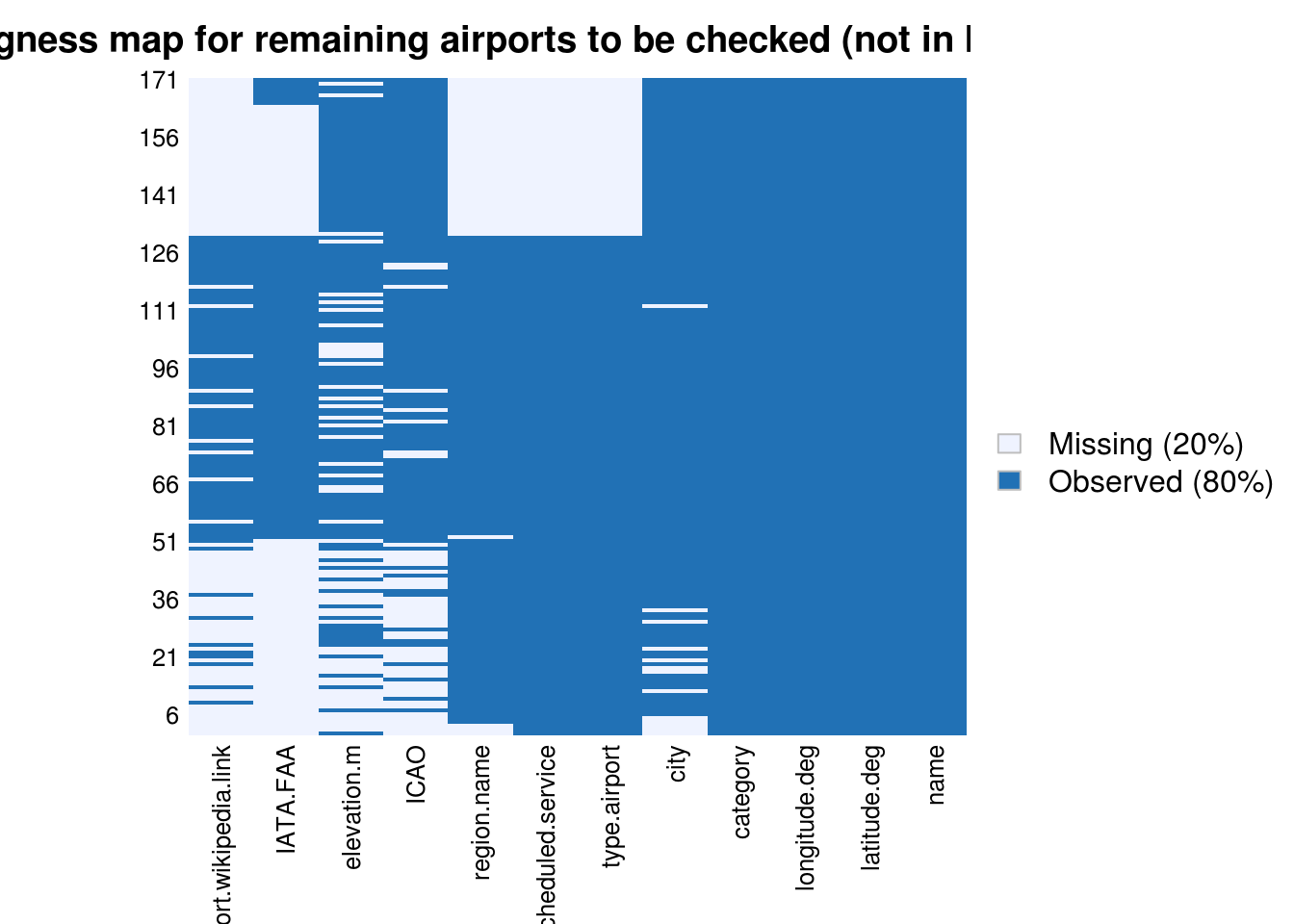
Checking and fixing IATA dataset
Reorganising columns
We update column order to get a clearer view when comparing data.
# reorder
IATA <- dplyr::select(IATA,
                      IATA.FAA, ICAO.x, ICAO.y,
                      name.x, name.y, city.x, city.y,
                      latitude.deg.x, latitude.deg.y,
                      longitude.deg.x, longitude.deg.y,
                      elevation.m.x, elevation.m.y,
                      category.x, category.y,
                      region.name, type.airport, scheduled.service, airport.wikipedia.link
)
Fixing ICAO codes
Let’s clean the ICAO codes, we will use the one from OurAiports. All missing values of OpenFlight are included in Ouraiports. Missing values of OurAirports are not found in Openflight data set (see previous missingness map)
IATA$ICAO <- IATA$ICAO.x
IATA <- dplyr::select(IATA, -ICAO.x, -ICAO.y)
missmap(IATA)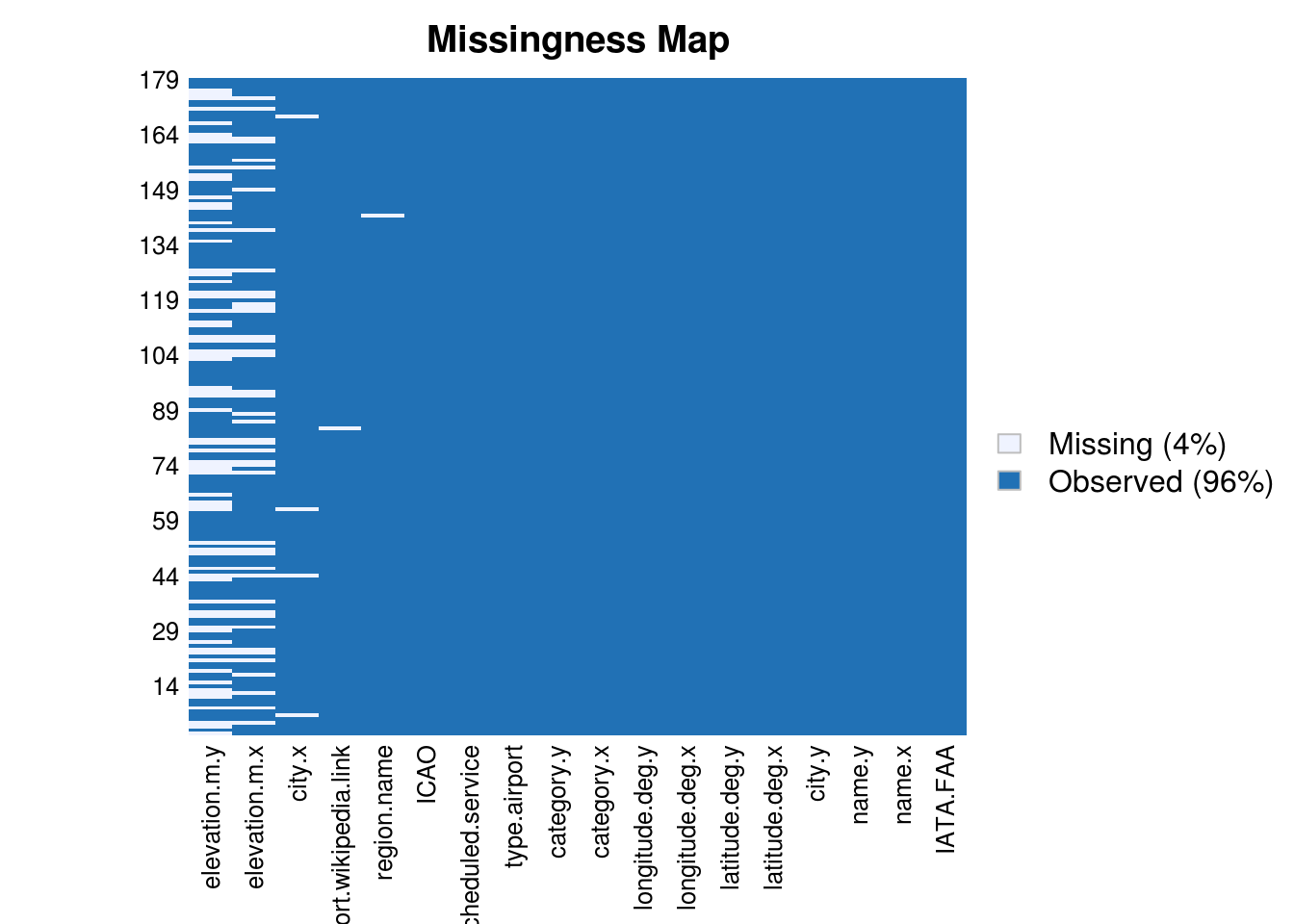
Fixing city name
No missing data in city.y, we replace missing city.x by associated city.y. There seems to be small typos in both data set (always for Chinese cities), we compare city names by calculating the distance between the character vectors. We keep city.x which seems better.
IATA[is.na(IATA$city.x),]$city.x <- IATA[is.na(IATA$city.x),]$city.y

dist <- stringdist(IATA$city.x, IATA$city.y)
hist(dist, breaks = 40)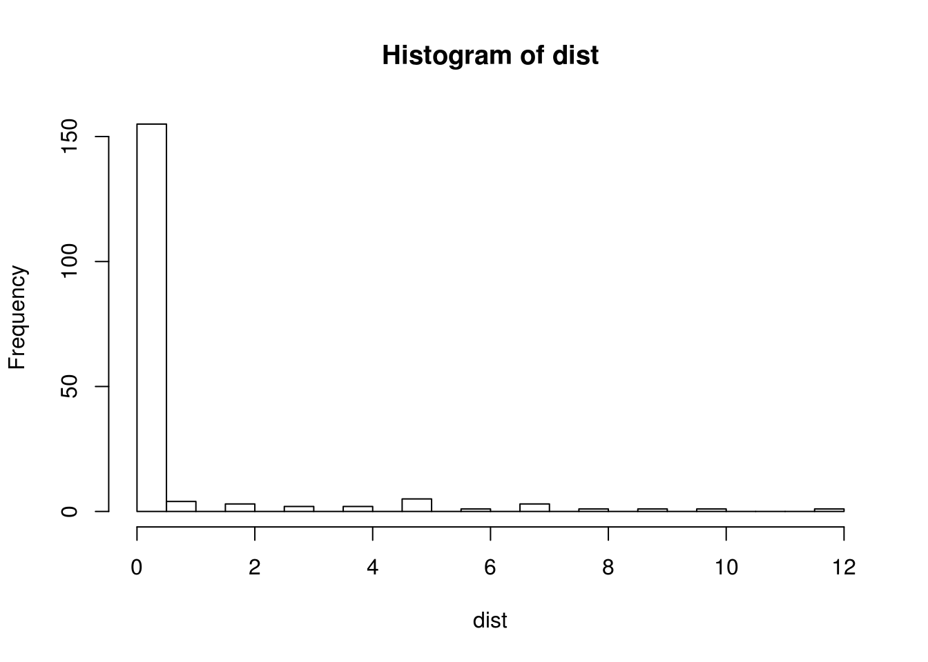
kable(dplyr::select(IATA[dist > 0,], city.x, city.y, name.x))| city.x | city.y | name.x | |
|---|---|---|---|
| 21 | Changsha | Changcha | Changsha Huanghua International Airport |
| 26 | Daocheng County | Daocheng | Daocheng Yading Airport |
| 30 | Xiaguan | Dali | Dali Airport |
| 33 | Ordos | Dongsheng | Ordos Ejin Horo Airport |
| 41 | Xiahe | Xiahe city | Gannan Xiahe Airport |
| 50 | Huai’an | Huai An | Lianshui Airport |
| 51 | Huaihua | Zhijiang | Zhijiang Airport |
| 66 | Jiagedaqi | Jiagedaqi District | Jiagedaqi Airport |
| 68 | Ji’an | Ji An | Jinggangshan Airport |
| 81 | Kashgar | Kashi | Kashgar Airport |
| 89 | Guilin City | Guilin | Guilin Liangjiang International Airport |
| 94 | Lüliang | Lvliang | Lüliang Airport |
| 106 | Meixian | Xi’an | Meixian Airport |
| 111 | Ningbo | Ninbo | Ningbo Lishe International Airport |
| 114 | Xinyuan County | Xi’an | Xinyuan Nalati Airport |
| 119 | Mohe | Mohe County | Gu-Lian Airport |
| 123 | Xigazê | Shigatse | Shigatse Air Base |
| 124 | Bavannur | Bayannur | Bayannur Tianjitai Airport |
| 130 | Pu’er | Simao | Pu’er Simao Airport |
| 145 | Ürümqi | Urumqi | Ürümqi Diwopu International Airport |
| 156 | Wanxian | Xi’an | Wanxian Airport |
| 157 | Xiangfan | Xi’an | Xiangyang Liuji Airport |
| 158 | Xichang | Xi’an | Xichang Qingshan Airport |
| 173 | Yangzhou and Taizhou | Yangzhou | Yangzhou Taizhou Airport |
IATA$city <- IATA$city.x
IATA <- dplyr::select(IATA, -city.x, -city.y)
missmap(IATA)
Fixing airport names
No missing data in name.y or name.x, we need to compare both by string distance. name.x is more detailed and better written. Except for Taoxian Airport.
dist <- stringdist(IATA$name.x, IATA$name.y)
hist(dist, breaks = 40)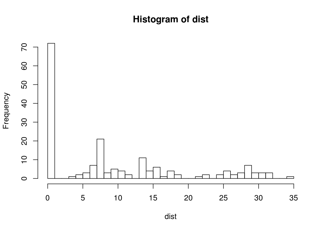
kable(head(dplyr::select(IATA[dist > 0,], name.x, name.y)))| name.x | name.y | |
|---|---|---|
| 1 | Altay Air Base | Altay Airport |
| 3 | Baise Youjiang Airport | Tianyang |
| 4 | Ankang Wulipu Airport | Ankang Airport |
| 6 | Anqing Tianzhushan Airport | Anqing Airport |
| 11 | Baoshan Yunduan Airport | Baoshan Airport |
| 12 | Guangzhou Baiyun International Airport | Baiyun Intl |
IATA[IATA$name.x == "Taoxian Airport",]$name.x <- "Shenyang Taoxian International Airport"
IATA$name <- IATA$name.x
IATA <- dplyr::select(IATA, -name.x, -name.y)
missmap(IATA)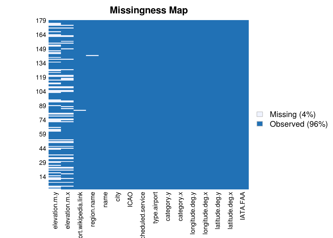
Fixing longitude.deg, latitude.deg
Values for longitude and latitude are different in the two data sets, we study in details the distance over 0.01 degree which represent roughly 500 meters.
dist1 <- abs(IATA$longitude.deg.x - IATA$longitude.deg.y)
dist2 <- abs(IATA$latitude.deg.x - IATA$latitude.deg.y)

par(mfrow = c(1,2))
hist(log(dist1), breaks = 40)
hist(log(dist2), breaks = 40)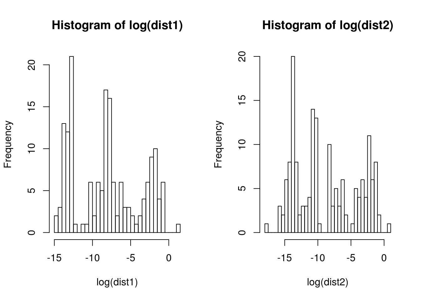
toCheck <- dplyr::select(IATA[dist1 > 0.05 & dist2 > 0.05,],
                         IATA.FAA, ICAO, airport.wikipedia.link,
                         latitude.deg.x, longitude.deg.x,
                         latitude.deg.y,  longitude.deg.y)

kable(toCheck)| IATA.FAA | ICAO | airport.wikipedia.link | latitude.deg.x | longitude.deg.x | latitude.deg.y | longitude.deg.y | |
|---|---|---|---|---|---|---|---|
| 15 | CGQ | ZYCC | https://en.wikipedia.org/wiki/Changchun_Longjia_International_Airport | 43.99620 | 125.68500 | 43.54120 | 125.12010 |
| 25 | DAX | ZUDX | https://en.wikipedia.org/wiki/Daxian_Airport | 31.13020 | 107.42950 | 31.30000 | 107.50000 |
| 31 | DNH | ZLDH | https://en.wikipedia.org/wiki/Dunhuang_Airport | 40.16110 | 94.80920 | 40.09400 | 94.48180 |
| 32 | DOY | ZSDY | https://en.wikipedia.org/wiki/Dongying_Shengli_Airport | 37.50860 | 118.78800 | 37.27160 | 118.28190 |
| 33 | DSN | ZBDS | https://en.wikipedia.org/wiki/Ordos_Ejin_Horo_Airport | 39.49000 | 109.86139 | 39.85000 | 110.03300 |
| 39 | FUO | ZGFS | https://en.wikipedia.org/wiki/Foshan_Shadi_Airport | 23.08330 | 113.07000 | 23.13333 | 113.28333 |
| 40 | GOQ | ZLGM | https://en.wikipedia.org/wiki/Golmud_Airport | 36.40060 | 94.78610 | 34.63300 | 98.86700 |
| 41 | GXH | ZLXH | https://en.wikipedia.org/wiki/Gannan_Xiahe_Airport | 34.81050 | 102.64470 | 34.49090 | 102.37190 |
| 60 | HZG | ZLHZ | https://en.wikipedia.org/wiki/Hanzhong_Chenggu_Airport | 33.13414 | 107.20601 | 33.06360 | 107.00800 |
| 61 | HZH | ZUNP | https://en.wikipedia.org/wiki/Liping_Airport | 26.32217 | 109.14990 | 26.20600 | 109.03900 |
| 62 | INC | ZLIC | https://en.wikipedia.org/wiki/Yinchuan_Hedong_International_Airport | 38.32276 | 106.39321 | 38.48194 | 106.00917 |
| 63 | IQM | ZWCM | https://en.wikipedia.org/wiki/Qiemo_Yudu_Airport | 38.23361 | 85.46556 | 38.14940 | 85.53280 |
| 71 | JIU | ZSJJ | https://en.wikipedia.org/wiki/Jiujiang_Lushan_Airport | 29.47694 | 115.80111 | 29.73300 | 115.98300 |
| 74 | JNG | ZSJG | https://en.wikipedia.org/wiki/Jining_Qufu_Airport | 35.29278 | 116.34667 | 35.41700 | 116.53300 |
| 84 | KMG | ZPPP | https://en.wikipedia.org/wiki/Kunming_Changshui_International_Airport | 25.10194 | 102.92917 | 24.99236 | 102.74354 |
| 87 | KRY | ZWKM | https://en.wikipedia.org/wiki/Karamay_Airport | 45.46655 | 84.95270 | 45.61700 | 84.88300 |
| 98 | LYA | ZHLY | https://en.wikipedia.org/wiki/Luoyang_Beijiao_Airport | 34.74110 | 112.38800 | 34.41000 | 112.28000 |
| 126 | SHE | ZYTX | https://en.wikipedia.org/wiki/Shenyang_Taoxian_International_Airport | 41.63980 | 123.48300 | 41.38240 | 123.29010 |
| 129 | SWA | ZGOW | https://en.wikipedia.org/wiki/Jieyang_Chaoshan_International_Airport | 23.55200 | 116.50330 | 23.40000 | 116.68300 |
| 138 | THQ | ZLTS | https://en.wikipedia.org/wiki/Tianshui_Maijishan_Airport | 34.55940 | 105.86000 | 34.33300 | 105.51400 |
| 139 | TLQ | ZWTP | https://en.wikipedia.org/wiki/Turpan_Jiaohe_Airport | 43.03080 | 89.09870 | 42.94233 | 89.18588 |
| 146 | UYN | ZLYL | https://en.wikipedia.org/wiki/Yulin_Yuyang_Airport | 38.35971 | 109.59093 | 38.26920 | 109.73100 |
| 149 | WNH | ZPWS | https://en.wikipedia.org/wiki/Wenshan_Puzhehei_Airport | 23.55830 | 104.32550 | 23.37583 | 104.24306 |
| 163 | XUZ | ZSXZ | https://en.wikipedia.org/wiki/Xuzhou_Guanyin_Airport | 34.05906 | 117.55528 | 34.16000 | 117.11000 |
| 171 | YNT | ZSYT | https://en.wikipedia.org/wiki/Yantai_Penglai_International_Airport | 37.65722 | 120.98722 | 37.40167 | 121.37167 |
Let’s now plot these airports.
g <- ggplot() + theme_bw()
## airports with elevation
g <- g + geom_point(data = toCheck, aes(x = longitude.deg.x, y = latitude.deg.x), col = "firebrick", pch = 3)
## airport with 0 m  as elevation in red
g <- g + geom_point(data = toCheck, aes(x = longitude.deg.y, y = latitude.deg.y), col = "blue", pch = 1)
g <- g + geom_text(data = toCheck, aes(x = longitude.deg.x, y = latitude.deg.x, label=IATA.FAA), size = 3, vjust = -1)
print(g)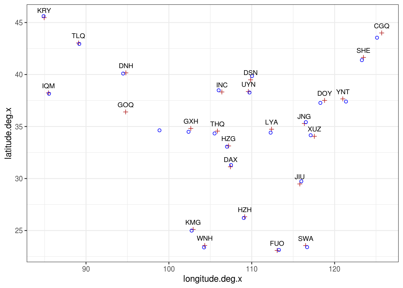
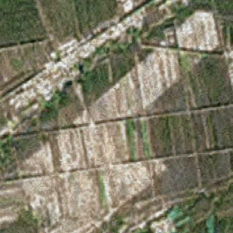
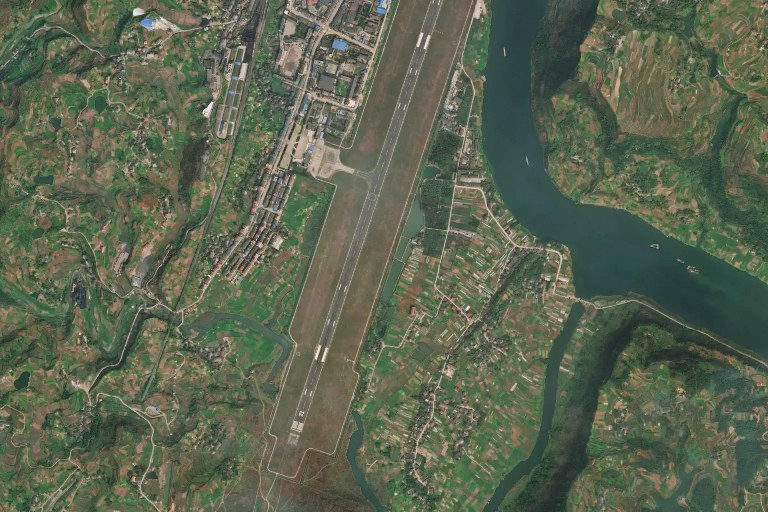
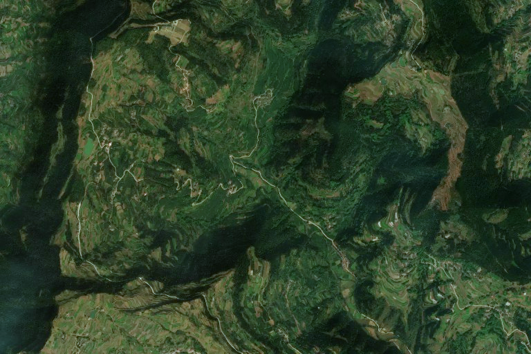
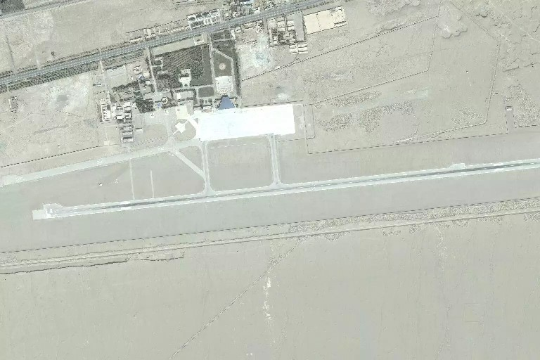
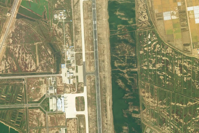
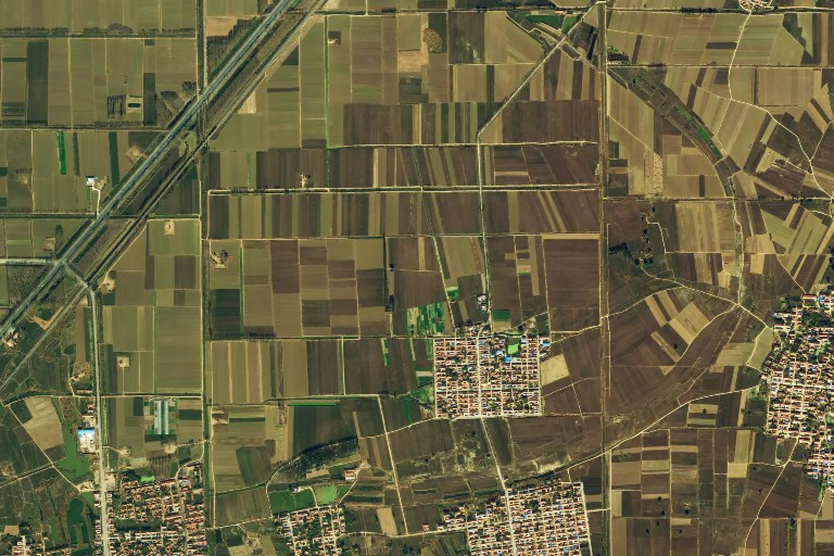
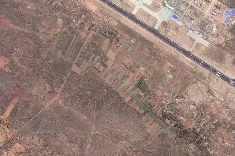
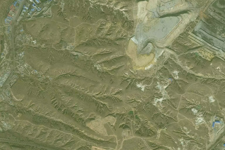
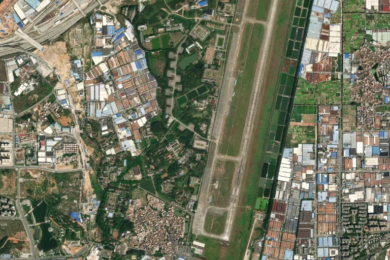
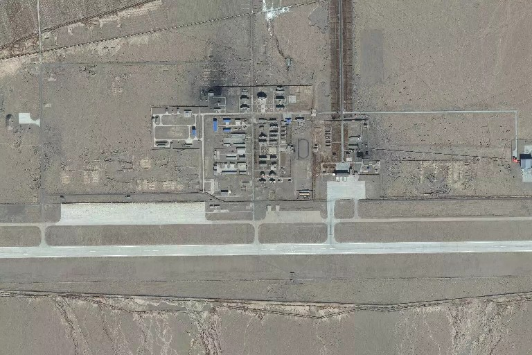
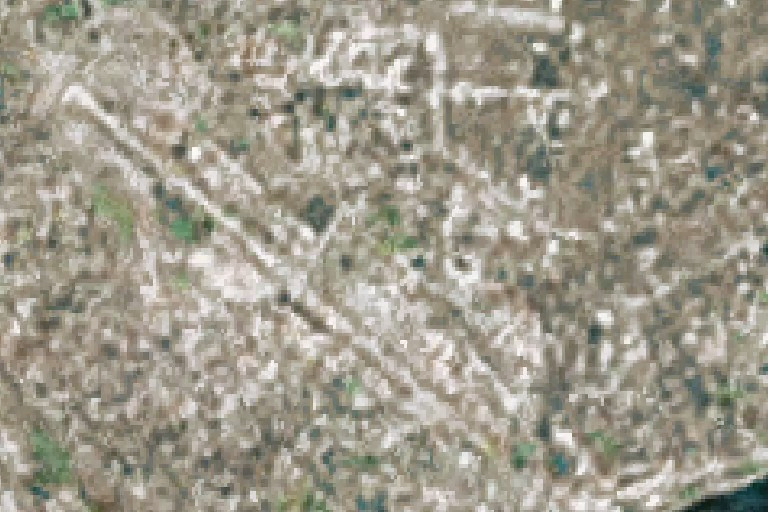
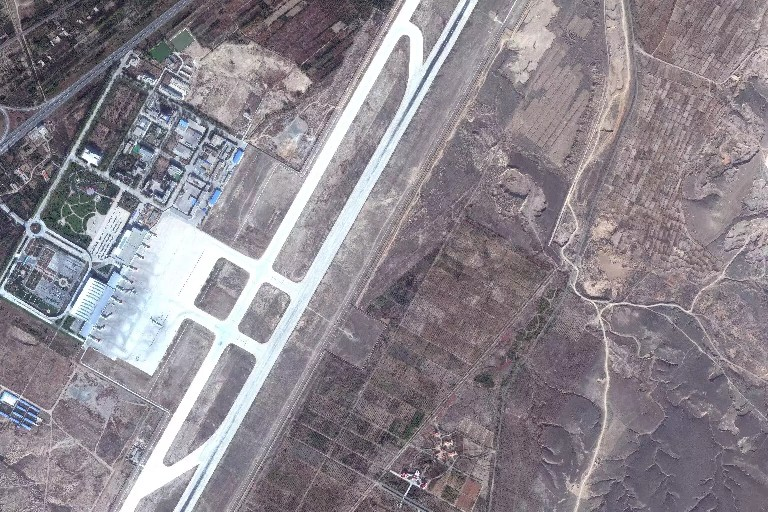
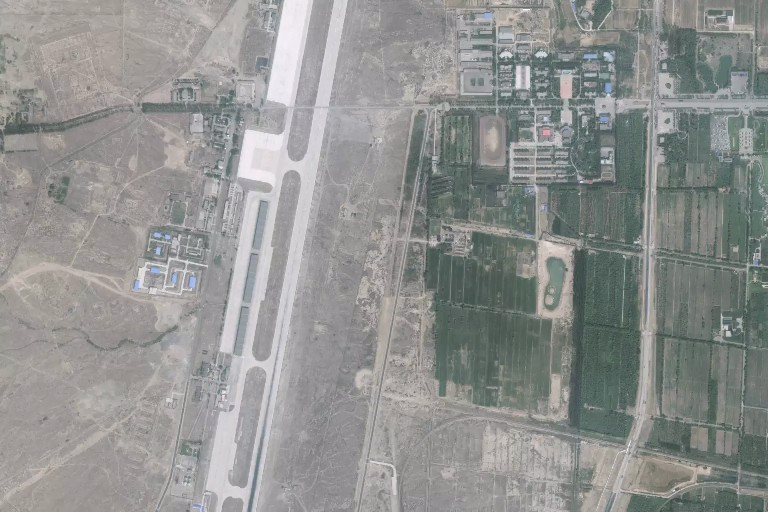
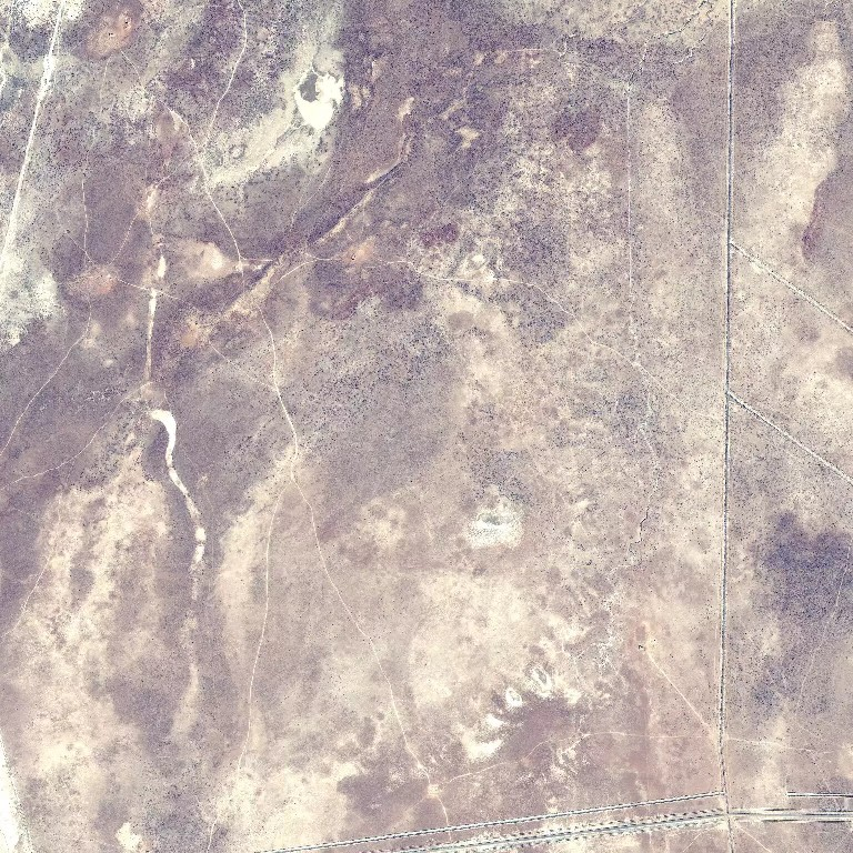
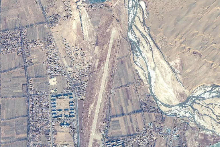
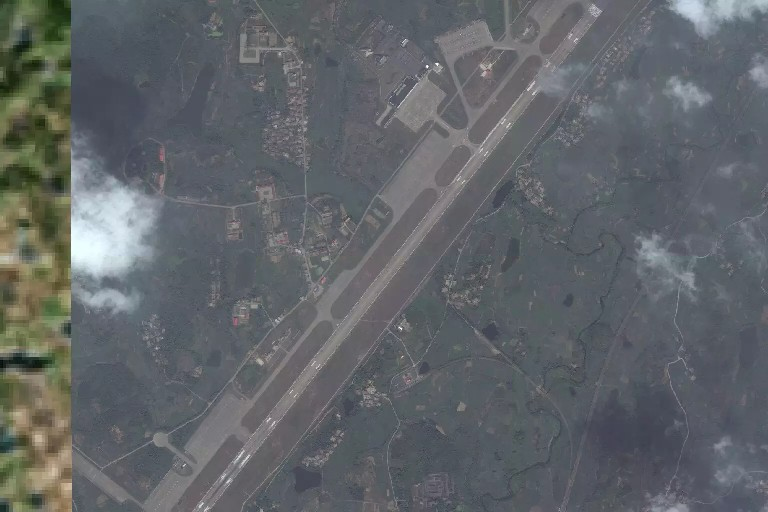
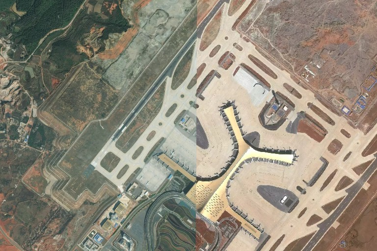
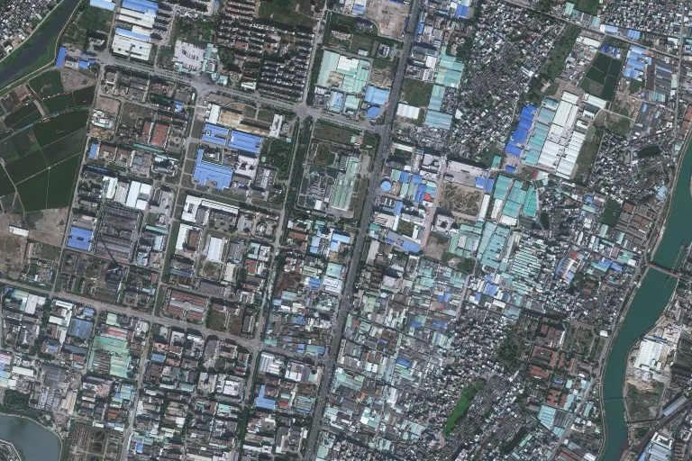
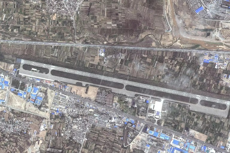
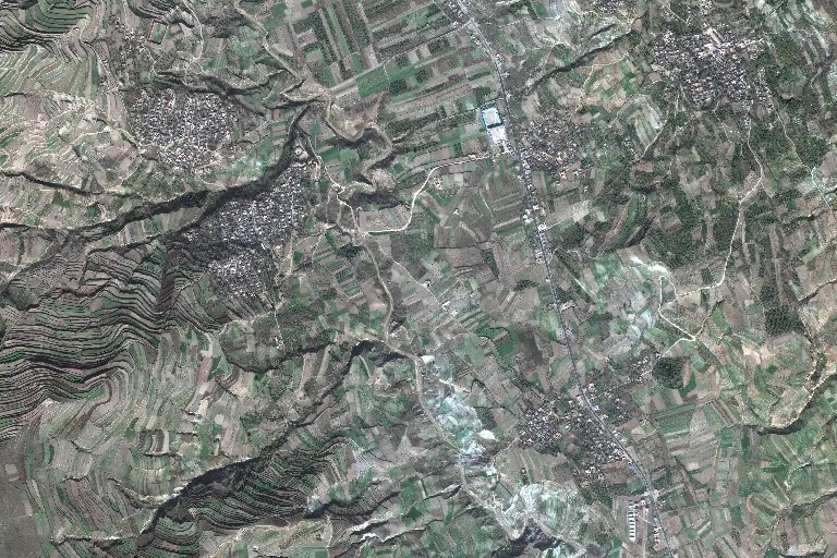
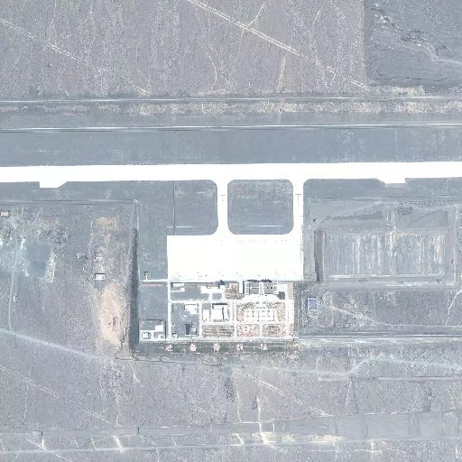
The map above shows there are significant error between the two data sets, now
let’s sample one case to check which data set is probably the most accurate.
We used for that the OpenStreetMap package to display side by side satellite
images around the latitude and longitude. This worked but for some unknown
reasons some tiles cannot be downloaded from travis.
So I changed strategy, using the API of mapbox instead but with longer and more
complicated code.
# set-up size of the bounding box to be visualized.
delta_lon <- 0.01
delta_lat <- 0.005
zoom_level <- 15


mapAirport <- function(
  my_lon, my_lat,
  my_delta_lat = 0.01,
  my_delta_lon = 0.005,
  my_zoom_level = 14,
  airport_id = 1,
  my_api_mapbox
) {
  ## Define bounding box
  myBbox <- c(xmin = my_lon - my_delta_lon,
              ymin = my_lat - my_delta_lat,
              xmax = my_lon + my_delta_lon,
              ymax = my_lat + my_delta_lat
  )
  # make the gridding
  myBboxTile <- slippymath::bbox_tile_query(bbox = myBbox)
  myGrid <- slippymath::bbox_to_tile_grid(myBbox, zoom = my_zoom_level)


  ## Download satellite data
  setwd(dir = "./sat/")

  mapbox_query_string <-
    paste0(
      "https://api.mapbox.com/v4/mapbox.satellite/{zoom}/{x}/{y}.jpg90",
      #"https://api.mapbox.com/v4/mapbox.satellite/{zoom}/{x}/{y}@2x.jpg90",
      "?access_token=",
      my_api_mapbox
    )


  ## Function to download Tiles
  myTiles <-
    pmap(.l = myGrid$tiles,
         zoom = myGrid$zoom,

         .f = function(x, y, zoom){
           outfile <- glue("{x}_{y}.jpg")
           curl_download(url = glue(mapbox_query_string),
                         destfile = outfile)
           outfile
         }
    )


  mySat <- slippymath::compose_tile_grid(myGrid, myTiles)
  #raster::plot(mySat)

  ## Go back to root directory
  setwd(dir = "../")
  #raster_to_png(mySat, "../../static/img/md/test_mapbox.png")
  raster_to_png(mySat, paste0("./img/airport_",airport_id,".png"))
  #knitr::include_graphics("/img/md/test_mapbox.png")
  #knitr::include_graphics(paste0("/blog/img/airport_",airport_id,".png"))
  return(paste0("/blog/img/airport_",airport_id,".png"))
  #overlay_image2 <- png::readPNG("final.png")
}
list_img <- NULL
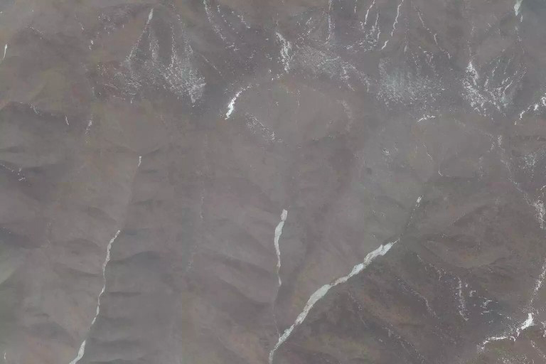
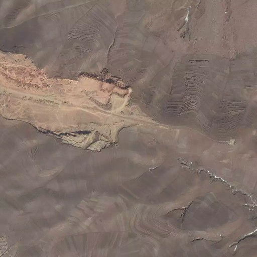
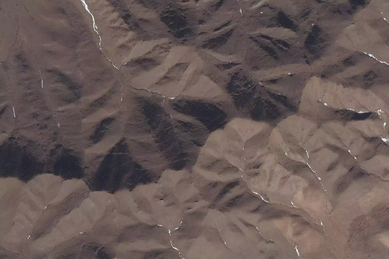
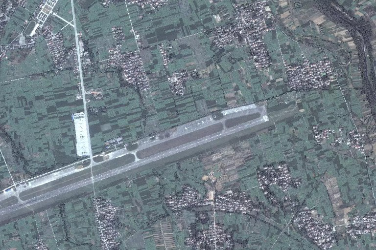
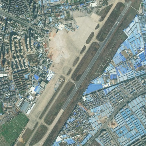
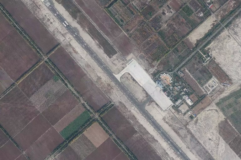
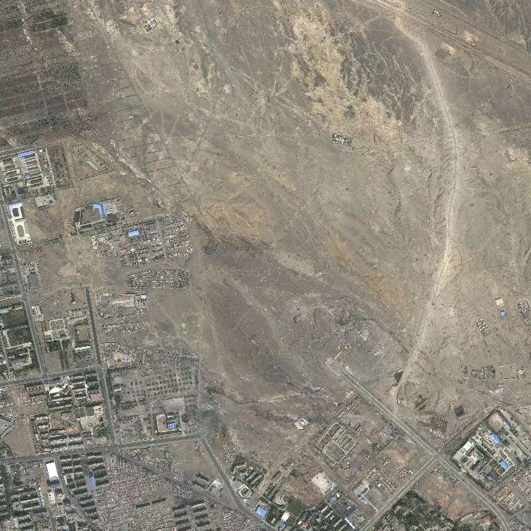
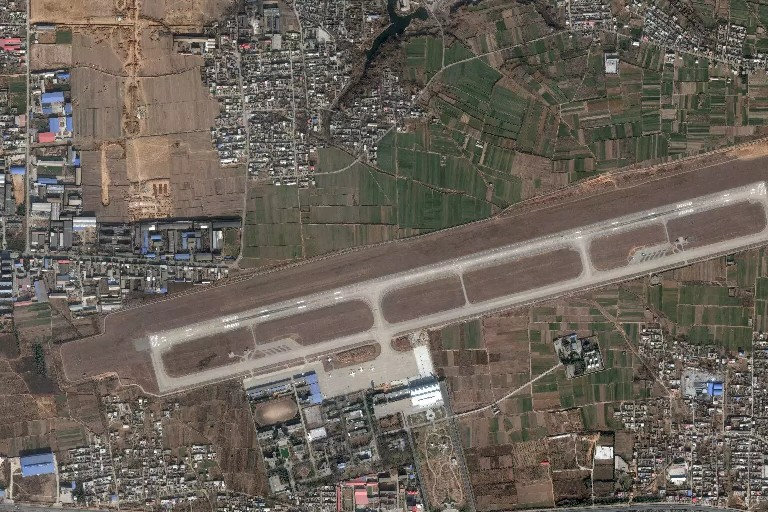
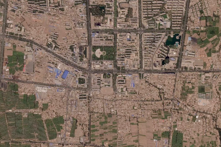
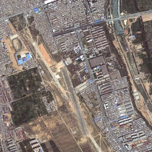
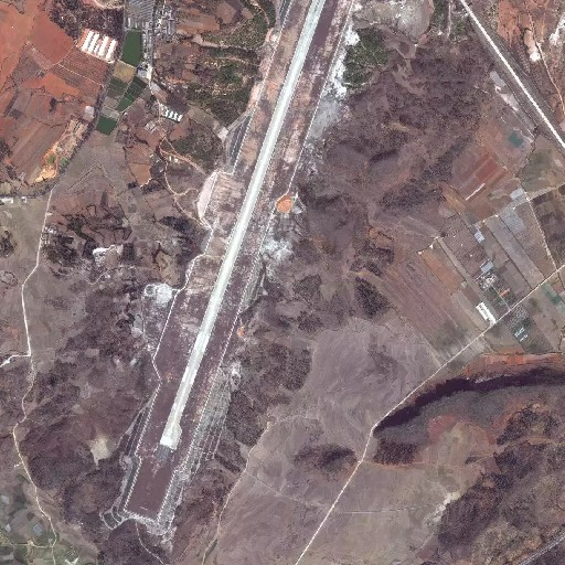
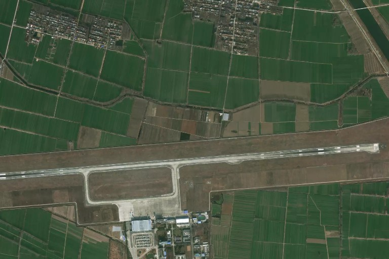
for( i in 1:nrow(toCheck)){
cat(paste0("<br/><br/><b>",toCheck[i,]$IATA.FAA,
" - <a href='",toCheck[i,]$airport.wikipedia.link,"'>",
toCheck[i,]$airport.wikipedia.link,"</a></b></br>\n"))
a <- mapAirport(
my_lon = toCheck[i,]$longitude.deg.x,
my_lat = toCheck[i,]$latitude.deg.x,
my_delta_lat = delta_lat,
my_delta_lon = delta_lon,
my_zoom_level = zoom_level,
airport_id = 2*i,
my_api_mapbox = api_mapbox
)
#cat(paste0("![",toCheck[i,]$IATA.FAA,"_OA](", a, " =300x)\n"))
cat(paste0("<img src=",a," alt='",toCheck[i,]$IATA.FAA,"_OA'"," width='300'/>\n"))
b <- mapAirport(
my_lon = toCheck[i,]$longitude.deg.y,
my_lat = toCheck[i,]$latitude.deg.y,
my_delta_lat = delta_lat,
my_delta_lon = delta_lon,
my_zoom_level = zoom_level,
airport_id = 2*i+1,
my_api_mapbox = api_mapbox
)
#cat(paste0("![",toCheck[i,]$IATA.FAA,"_OF](", b, " =300x)\n"))
cat(paste0("<img src=",b," alt='",toCheck[i,]$IATA.FAA,"_OF'"," width='300'/>\n"))
}
CGQ - https://en.wikipedia.org/wiki/Changchun_Longjia_International_Airport
DAX - https://en.wikipedia.org/wiki/Daxian_Airport
DNH - https://en.wikipedia.org/wiki/Dunhuang_Airport

DOY - https://en.wikipedia.org/wiki/Dongying_Shengli_Airport
DSN - https://en.wikipedia.org/wiki/Ordos_Ejin_Horo_Airport
FUO - https://en.wikipedia.org/wiki/Foshan_Shadi_Airport
GOQ - https://en.wikipedia.org/wiki/Golmud_Airport
GXH - https://en.wikipedia.org/wiki/Gannan_Xiahe_Airport
HZG - https://en.wikipedia.org/wiki/Hanzhong_Chenggu_Airport
HZH - https://en.wikipedia.org/wiki/Liping_Airport
INC - https://en.wikipedia.org/wiki/Yinchuan_Hedong_International_Airport
IQM - https://en.wikipedia.org/wiki/Qiemo_Yudu_Airport
JIU - https://en.wikipedia.org/wiki/Jiujiang_Lushan_Airport
JNG - https://en.wikipedia.org/wiki/Jining_Qufu_Airport
KMG - https://en.wikipedia.org/wiki/Kunming_Changshui_International_Airport
KRY - https://en.wikipedia.org/wiki/Karamay_Airport
LYA - https://en.wikipedia.org/wiki/Luoyang_Beijiao_Airport
SHE - https://en.wikipedia.org/wiki/Shenyang_Taoxian_International_Airport
SWA - https://en.wikipedia.org/wiki/Jieyang_Chaoshan_International_Airport
THQ - https://en.wikipedia.org/wiki/Tianshui_Maijishan_Airport
TLQ - https://en.wikipedia.org/wiki/Turpan_Jiaohe_Airport
UYN - https://en.wikipedia.org/wiki/Yulin_Yuyang_Airport

WNH - https://en.wikipedia.org/wiki/Wenshan_Puzhehei_Airport
XUZ - https://en.wikipedia.org/wiki/Xuzhou_Guanyin_Airport

YNT - https://en.wikipedia.org/wiki/Yantai_Penglai_International_Airport
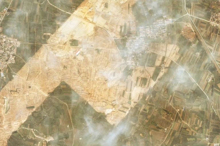
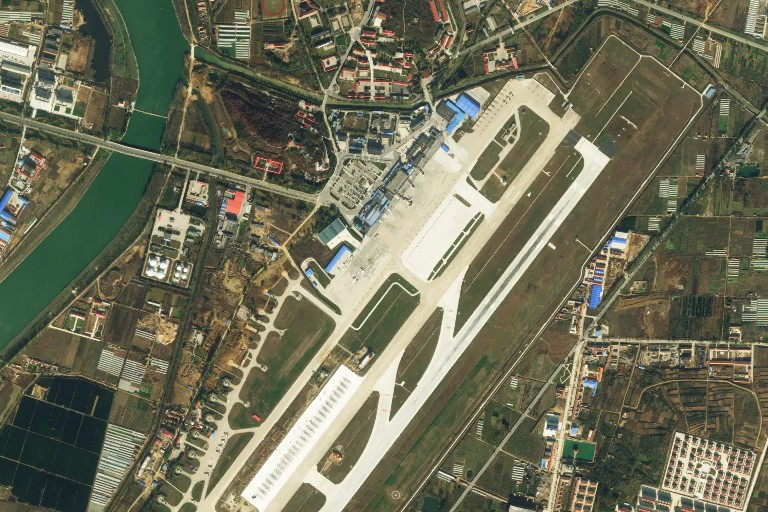
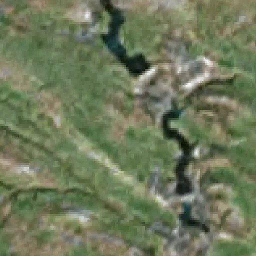
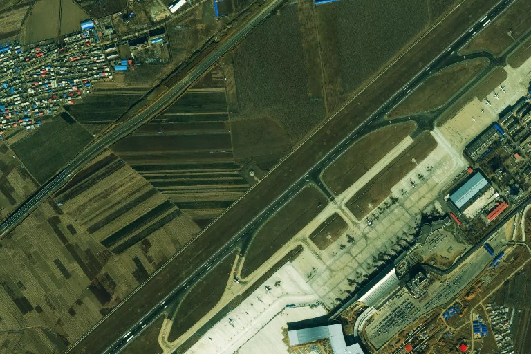
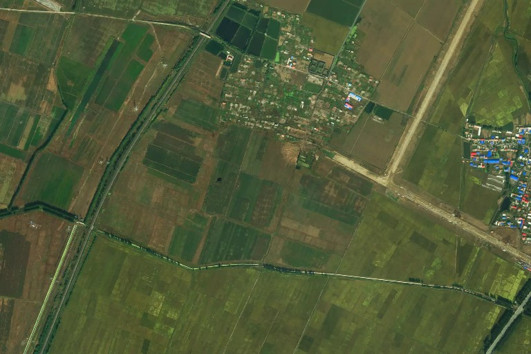
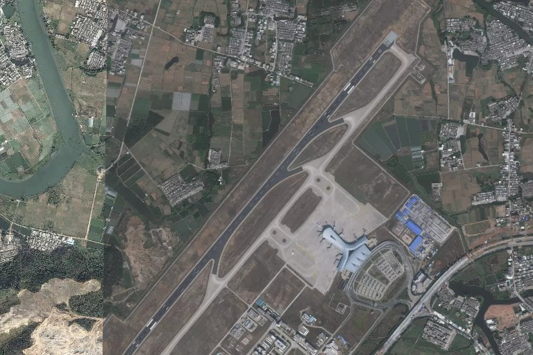
As a conclusion for this part, OA seems to be more accurate than OF regarding the airport longitude and latitude. We decide to keep OA data and drop OF data. note we should confirm that openstreetmap satellite is accurate in China and there is not shift phenomenon.
IATA$latitude.deg <- IATA$latitude.deg.x
IATA$longitude.deg <- IATA$longitude.deg.x
IATA <- dplyr::select(IATA, -latitude.deg.x, -latitude.deg.y, -longitude.deg.x, -longitude.deg.y)
Nevertheless as shown in the case of ZLXH airport the data of OA seems inaccurate. Further check is probably needed. note 2 Comparison is done here manually, we will see in another post how to make this detection using machine learning algorithms.
Fixing categories
They are same in both data sets except the following. We decide to keep OF categories.
## mismatch in category
IATA[!(IATA$category.x == IATA$category.y),]$name
## [1] "Altay Air Base" "Shigatse Air Base"IATA$category <- IATA$category.y
IATA <- dplyr::select(IATA, -category.x, -category.y)
missmap(IATA)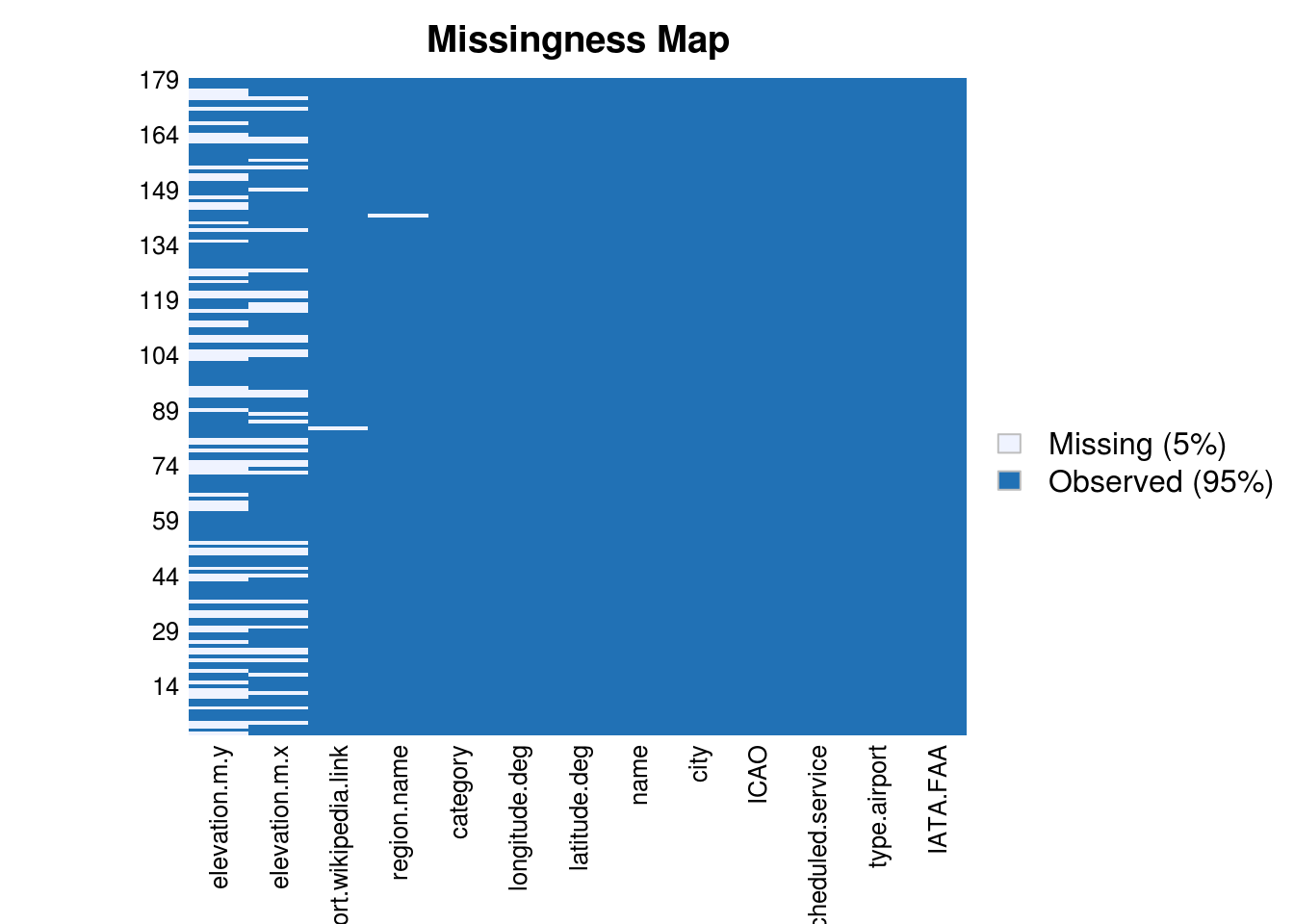
Fixing elevation.m data
As we have decided to drop OF latitude and longitude we should also drop the elevation from OF data set.
IATA$elevation.m <- IATA$elevation.m.x
IATA <- dplyr::select(IATA, -elevation.m.y, -elevation.m.x)
We have two actions to check and fix elevation data : check if the elevation is consistent with latitude and longitude and find missing elevation data.
We can use for this purpose the jawq API which returns in JSON format the elevation value for a given set of latitude / longitude.
# function which return evelevation based on longitude / latitude
# https://developers.google.com/maps/documentation/elevation/intro

getElevation <- function(lat,long) {
  lat <- as.numeric(lat)
  long <- as.numeric(long)
  # elevation API
  #baseUrl <- "https://api.jawg.io/elevations?locations="
  baseUrl <- "https://maps.googleapis.com/maps/api/elevation/json?locations="

  Url <- paste(baseUrl, lat, "," , long, "&key=", api_elevation, sep = "")

  jsonData <- fromJSON(Url)
  #Sys.sleep(1)
  elevation <- jsonData$results$elevation
  elevation
  #Url
}
## get elevation for all aiports
#IATA$elevationCheck <- 1
elevationCheck <- apply(IATA, 1, function(x) getElevation(x[9],x[10]))
IATA$elevationCheck <- elevationCheckWe are now going to check the gap between Google data and OA data set.
## replace missing elevation by google values
IATA[is.na(IATA$elevation.m),]$elevation.m <- IATA[is.na(IATA$elevation.m),]$elevationCheck
dist <- (abs(IATA$elevation.m - IATA$elevationCheck))
hist(dist, breaks = 40)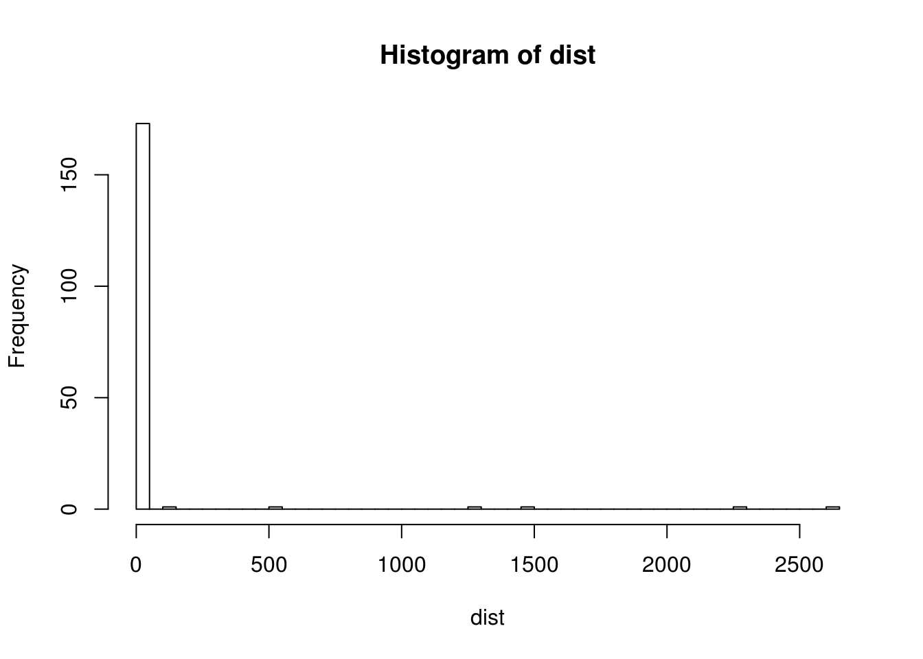
summary(dist)## Min. 1st Qu. Median Mean 3rd Qu. Max.
## 0.0000 0.1071 2.1109 50.4120 6.2938 2648.6264dplyr::select(IATA[dist > 30,], IATA.FAA, ICAO, elevation.m, elevationCheck, longitude.deg, latitude.deg)## IATA.FAA ICAO elevation.m elevationCheck longitude.deg latitude.deg
## 26 DCY ZUDC 4419.749 4389.1841 100.05333 29.32306
## 46 HEK ZYHE 2605.062 316.7160 127.30888 50.17162
## 79 KCA ZWKC 1076.230 1031.4375 82.87292 41.67786
## 116 NNY ZHNY 256.536 123.4809 112.61500 32.98080
## 122 PZI ZUZH 494.748 1963.4302 101.79852 26.54000
## 123 RKZ ZURK 1155.023 3803.6492 89.31140 29.35190
## 137 TGO ZBTL 731.433 183.6307 122.20000 43.55670
## 178 ZHY ZLZW 2504.891 1237.2886 105.15445 37.57312We have 8 airports with more than 30 meters of elevation error. After checking, we find out that Jawg data is more accurate and use it for these airports.
IATA[dist > 30,]$elevation.m <- IATA[dist > 30,]$elevationCheck
IATA <- dplyr::select(IATA, -elevationCheck)
missmap(IATA)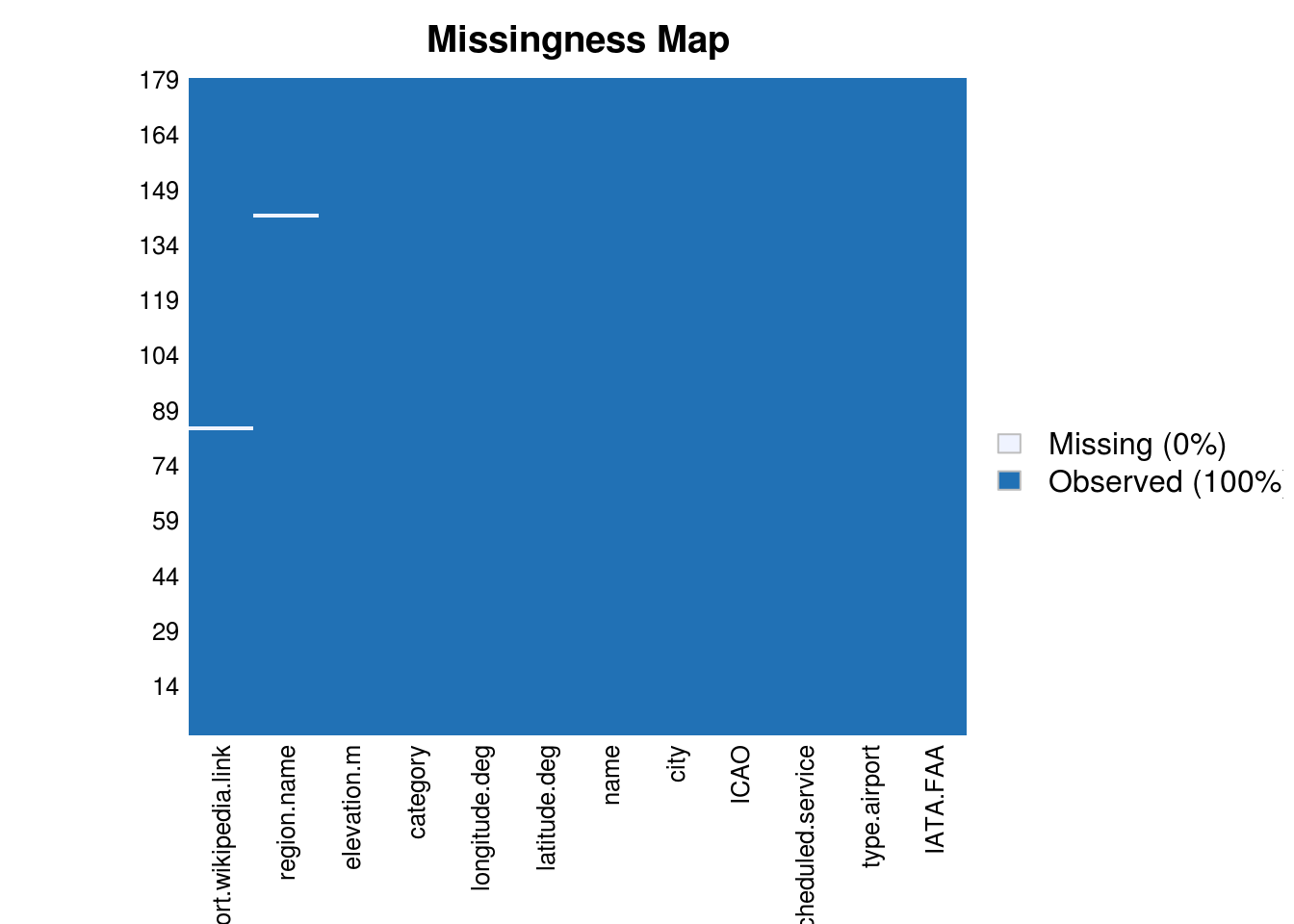
We use information from [http://www.geoplaner.com/#Coordinate-Converter] for setting
Saving objects for next part
Let’s now save the different objects to be reused in the next part of this post.
save( list = c("IATA",
               "airports_2_check"
),
file = "./data/chinese-airports-part-4.Rda")
Code information
Source code
The source code of this post is available on github
Session information
sessionInfo()## R version 3.6.1 (2017-01-27)
## Platform: x86_64-pc-linux-gnu (64-bit)
## Running under: Ubuntu 16.04.6 LTS
##
## Matrix products: default
## BLAS: /home/travis/R-bin/lib/R/lib/libRblas.so
## LAPACK: /home/travis/R-bin/lib/R/lib/libRlapack.so
##
## locale:
## [1] LC_CTYPE=en_US.UTF-8 LC_NUMERIC=C
## [3] LC_TIME=en_US.UTF-8 LC_COLLATE=en_US.UTF-8
## [5] LC_MONETARY=en_US.UTF-8 LC_MESSAGES=en_US.UTF-8
## [7] LC_PAPER=en_US.UTF-8 LC_NAME=en_US.UTF-8
## [9] LC_ADDRESS=en_US.UTF-8 LC_TELEPHONE=en_US.UTF-8
## [11] LC_MEASUREMENT=en_US.UTF-8 LC_IDENTIFICATION=en_US.UTF-8
##
## attached base packages:
## [1] grid stats graphics grDevices utils datasets methods
## [8] base
##
## other attached packages:
## [1] curl_4.3 purrr_0.3.3 png_0.1-7
## [4] raster_3.0-7 glue_1.3.1 slippymath_0.3.1
## [7] knitr_1.26 stringdist_0.9.5.5 OpenStreetMap_0.3.4
## [10] Amelia_1.7.6 Rcpp_1.0.3 jsonlite_1.6
## [13] ggplot2_3.2.1 dplyr_0.8.3 reshape2_1.4.3
## [16] maptools_0.9-9 sp_1.3-2
##
## loaded via a namespace (and not attached):
## [1] highr_0.8 compiler_3.6.1 pillar_1.4.2 plyr_1.8.5
## [5] tools_3.6.1 digest_0.6.23 evaluate_0.14 tibble_2.1.3
## [9] lifecycle_0.1.0 gtable_0.3.0 lattice_0.20-38 pkgconfig_2.0.3
## [13] rlang_0.4.2 parallel_3.6.1 rgdal_1.4-8 yaml_2.2.0
## [17] blogdown_0.17.1 xfun_0.11 rJava_0.9-11 withr_2.1.2
## [21] stringr_1.4.0 tidyselect_0.2.5 R6_2.4.1 foreign_0.8-72
## [25] rmarkdown_1.18 bookdown_0.16 farver_2.0.1 magrittr_1.5
## [29] codetools_0.2-16 scales_1.1.0 htmltools_0.4.0 assertthat_0.2.1
## [33] colorspace_1.4-1 labeling_0.3 stringi_1.4.3 lazyeval_0.2.2
## [37] munsell_0.5.0 crayon_1.3.4