Demography

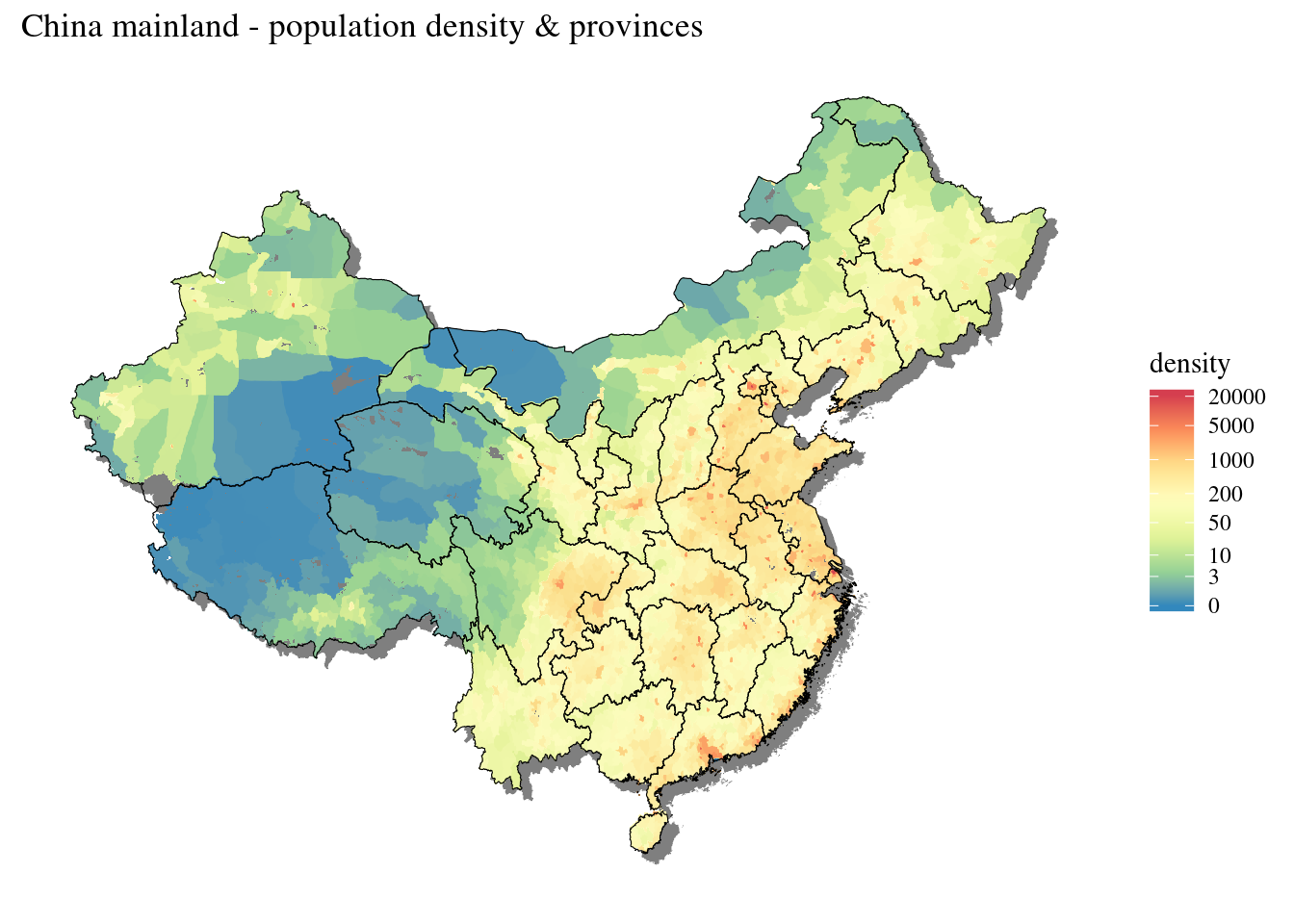
China mainland population density

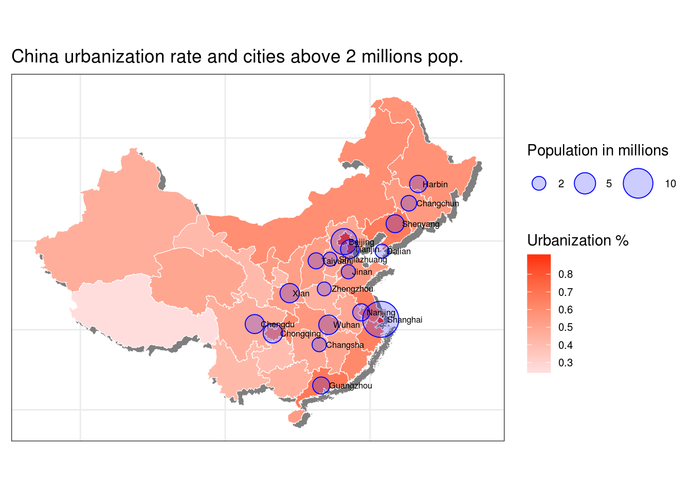
In an earlier post we mapped the urbanization rate of China at province level. In this post we will go futher by visualizing where Chinese people are living using a gridded population map. We will use the NASA dataset (Population Density Grid, v3 (1990, 1995, 2000)) which consists of estimates of human population by 2.5 arc-minute grid cells. A proportional allocation gridding algorithm, utilizing more than 300,000 national and sub-national administrative units, is used to assign population values to grid cells.

Continue reading

China Urbanisation & Large cities

In this article we are going to plot a map of China urbanization rate per provinces together with Chinese cities with at least 2 millions population. In a nutshell, we’ll get first rural and urban population data from official China statistic bureau, then clean the data, we’ll repeat the same two steps for Chinese largest cities. Secondly, we’ll prepare a map of China with provinces. Then we will add the main Chinese cities and their population and a choropleth of urbanization rate, add main cities

Continue reading